Atlas Play › Print-and-play cards
Atlas Cards: print-and-play country cards
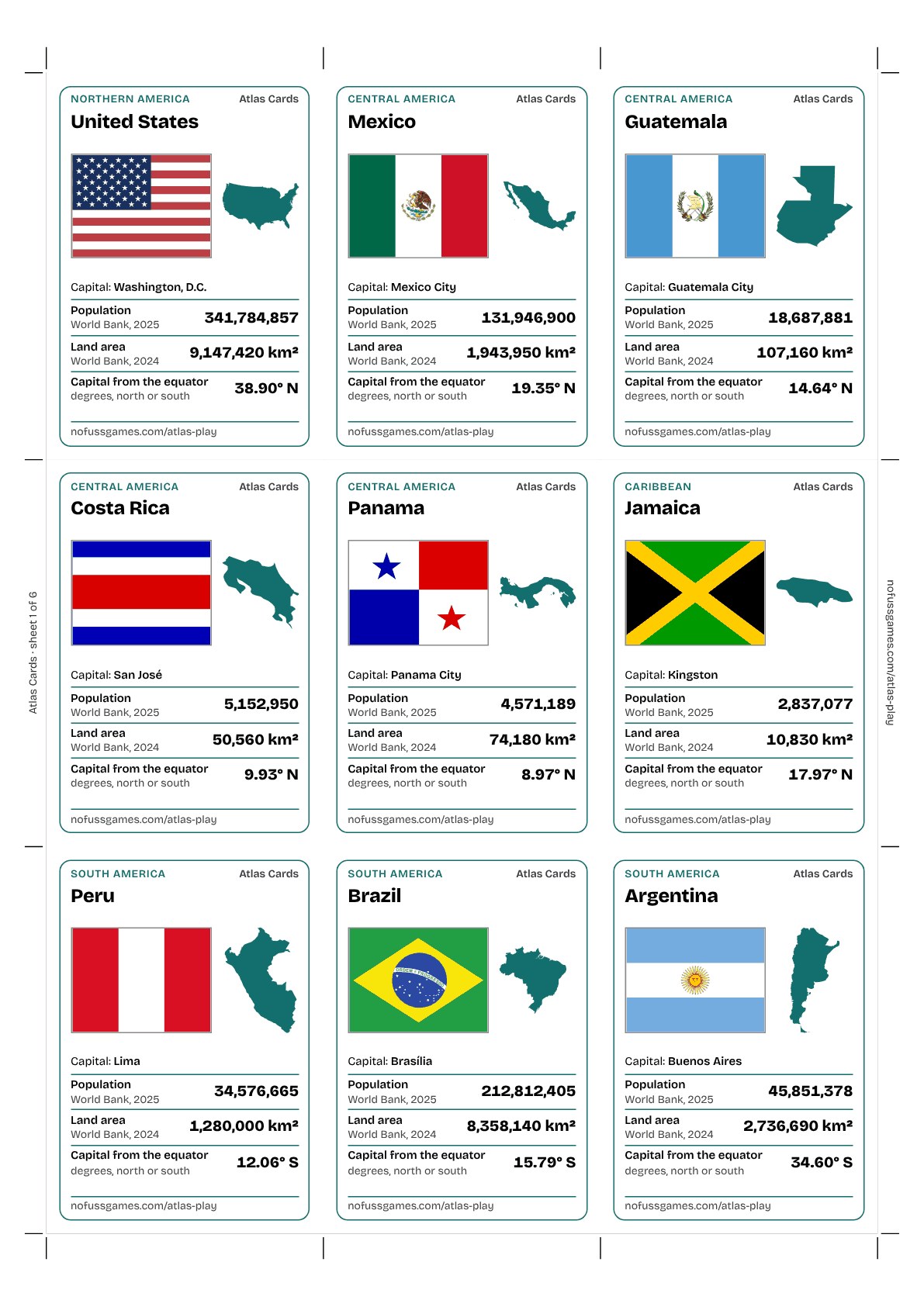
A country card game for the kitchen table and the classroom: pick a category, read your number, and the highest wins the cards. 54 countries from every inhabited continent, each with its flag, its outline and checked numbers.
- 54 countries
- 3 categories
- 2–6 players, ages 8+
- A4 and US Letter
- Rules, teacher notes, blank cards
How to print and play
- Print. Download the cards PDF for A4 or US Letter and print it at 100% (actual size), ideally on thin card. For backs, use the double-sided PDF.
- Cut. Cut along the grey lines or between the corner marks: six sheets give 54 cards of 63 × 88 mm.
- Deal. Shuffle and deal all the cards face down. Each player holds a pile and looks only at the top card.
- Play. Choose a category from your top card and read it out; everyone reads the same category, and the highest number takes the cards.
The categories
Population
How many people live there: the World Bank’s estimate for 2025.
Land area
Square kilometres of land, without big lakes and rivers: World Bank, 2024.
Capital from the equator
How far the capital lies from the equator, in degrees of latitude. North or south doesn’t matter: further wins.
Higher number wins in every category. A tie sends the cards to the middle for the next round.
The 54 countries
Africa
Egypt, Tanzania, Uganda, South Africa, Namibia, Madagascar, Nigeria, Ghana, Senegal, Tunisia
Americas
United States, Mexico, Guatemala, Costa Rica, Panama, Jamaica, Peru, Brazil, Argentina, Chile, Uruguay, Ecuador
Asia
Türkiye, Armenia, Nepal, China, Mongolia, Japan, South Korea, Vietnam, Philippines, India, Thailand, Singapore, Malaysia
Europe
United Kingdom, Ireland, Czechia, Germany, Spain, Portugal, Switzerland, Austria, Sweden, Poland, France, Italy, Greece, Iceland
Oceania
For teachers
What it practises
Reading and comparing big numbers, continents, capitals and flags, latitude, and people per square kilometre as a ratio.
Checked numbers
Population and land area are World Bank figures (2025 and 2024); capital positions are from Wikidata, checked against Natural Earth. The teacher notes say what each number means.
Make your own
The rules PDF ends with a sheet of blank cards: pupils research a country that isn’t in the deck and add it to the game.
Using the cards
Free to print for personal, classroom and library use. Please don’t sell or republish the cards. No sign-up, no email: the links above are the files.